Global Fishing Watch follows the release of a new layer for its public searchable map to keep an eye on the oceans with the creation of a new portal to make application programming interfaces available to the public.
National Fisherman reported last July that Global Fishing Watch has developed and publicly released the first ever global map of previously undetected dark fleets, or vessels that do not broadcast their location or appear in public monitoring systems, showing how emerging technologies contribute to build a true global footprint of fishing activity. Powered by satellite radar imagery and machine learning, the new interactive map layer from Global Fishing Watch reveals a global view of hidden vessels around the world.
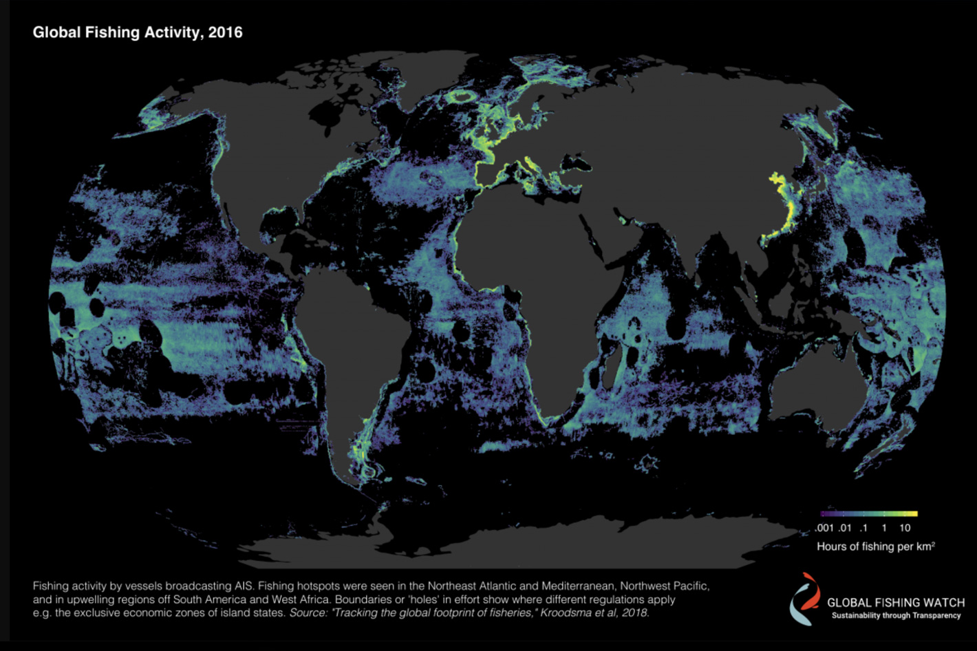
Global Fishing Watch published the first high-resolution map of global fishing activity in 2018. Its findings revealed that commercial fishing takes place across more than 55 percent of the ocean—a footprint, by area, greater than four times that of agriculture. Since then, the map has grown in sophistication, offering a variety of information, including the recent layer, revealing previously undetected dark fleets.
The organization has also announced that it has established a new portal to make application programming interfaces available to public.
Partners and researchers already use Global Fishing Watch data in many creative and powerful ways but, according to Anna Sanders, the director of product development at Global Fishing Watch, “as a small team, we are unable to focus on every important issue facing the ocean today, so unleashing our knowledge in an automated and flexible framework will deliver greater access to other innovators who can develop and deploy actionable solutions to address ocean stressors.”
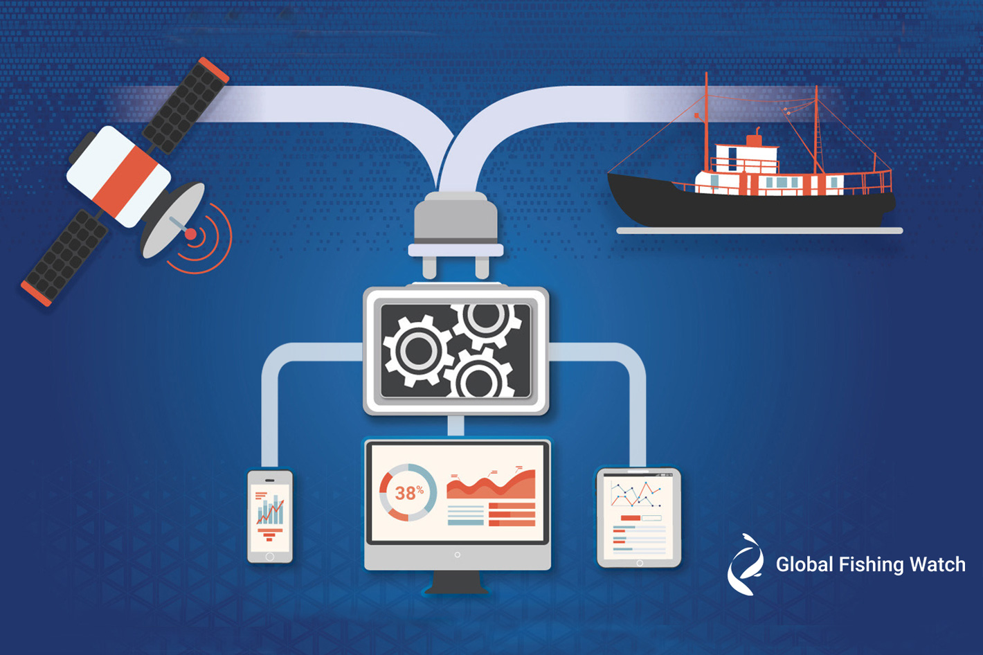
The portal provides access to a set of APIs, or application programming interfaces, which enable two software systems to communicate with one another by automatic retrieval of data.
The portal provides access to a set of APIs, or application programming interfaces, which enable two software systems to communicate with one another by automatic retrieval of data. They are the foundation of Global Fishing Watch’s technology and allow the organization to integrate, share, access and scale the data it collects — first to power its map and now across the global ocean community.
 Partnership with SeaSketch
Despite being used as the base to study a variety of cases, whether it’s estimating global collision-risk hotspots of marine traffic to whale sharks or revealing global risks of labor abuse and illegal, unreported and unregulated fishing the Global Fishing Watch map is not enough to solve all the problems, as the international community continues to fall short in its efforts to conserve and sustainably use the ocean and marine resources, a United Nations Sustainable Development Goal.
Therefore, according to Anna Sanders, “we must work to collaborate more effectively to develop new solutions to mitigate or reverse human impacts to our ocean ecosystems.”
By giving access to its API portal, Global Fishing Watch “allows partners and stakeholders a new way to access dynamic datasets that are used in all our tools and incorporate them directly into their own systems, platforms and research.” The API provides access to map tiling, visualizations of apparent fishing activity and events derived from automatic identification system (AIS) data, as well as the ability to search for a vessel.
With this data, users can understand more about vessel movements and events, including encounter events between a carrier and fishing vessels, loitering activity and port visits.
According to Global Fishing Watch, “new technologies can be developed using our APIs to address the various threats facing our ocean. To kick off our work with partners, Global Fishing Watch is teaming up with SeaSketch to integrate AIS-derived apparent fishing activity data and visualizations into their marine spatial planning platform.
This will supplement other data sources, including ocean use surveys that SeaSketch uses to inform the placement of new marine protected areas. Improved access and interconnectedness to our data will help lead to more informed management decisions based on the best available data and science. “
 Global Fishing Watch plans for 2023
The opportunities are endless, says Anna Sanders, noting that “our APIs can be combined with other data sources, too. By integrating AIS-derived apparent fishing activity with sea-surface temperature data, researchers can begin to identify shifts in fishing behavior due to marine heatwaves and climate change. Geomorphic and benthic coral maps can also be analyzed with AIS-derived apparent fishing activity to pinpoint interactions of fishing and shipping vessels with coral reefs.”
Access to the Global Fishing Watch APIs is easy. Here is all you need to do:
- Register for a Global Fishing Watch account
- Request an API Key
- Agree to the terms of service and attribute Global Fishing Watch in anything you publish
- Participate in follow-up surveys
Global Fishing Watch believes this may be the start of something good. The organization says that in 2023 “we will be planning a hackathon to create community-led solutions in regions most affected by illegal fishing, climate change and other ocean threats. Participants will hack together data and technology to create actionable, impactful solutions for ocean and environmental challenges in their communities.”


