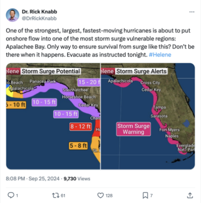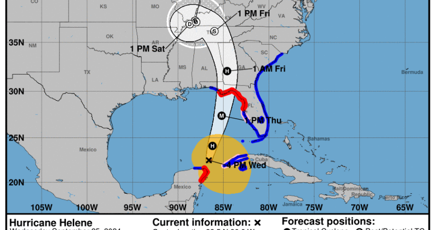
Hurricane Helene is accelerating its pace north across the Gulf of Mexico and expected to strengthen to a category 4 storm, before making landfall Thursday evening on Florida’s Big Bend coastline with storm surge up to 20 feet, the National Hurricane Center said.
Forecasters say Helene will intensify to sustained windspeeds of 115 knots. Its course will interact with the gulf’s Loop Current, where water temperature around 86 degrees Fahrenheit will help energize the storm as it heads for the coast and then inland near Tallahassee and into Georgia.
Widespread storm surges along the Florida west coast could reach 15 to 20 feet from Carrabelle to Suwannee River and 5 to 8 feet at Tampa Bay.
The Coast Guard 7th District headquarters said Wednesday morning that an area command post was established at Coast Guard Air Station Miami in Opa Locka, Fla.,
The scenario is similar to Hurricane Idalia when it made its Florida landfall in August 2023, with winds of 125 knots along the Big Bend before weakening to category 2 and moving north into Georgia. But the National Hurricane Center is warning that surge and flash flooding from Helene could extend far inland.