Hoonah
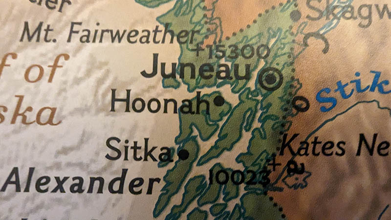
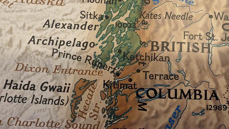
Published onHoonah (Tlingit: Xunaa or Gaaw Yataḵ Aan) is a largely Tlingit community on Chichagof Island, located in Alaska's panhandle in the southeast region of the state. It is 30 miles (48 km) west of Juneau, across the Alaskan Inside Passage. Hoonah is the only first-class city on Chichagof Island, the 109th-largest island in the world and the 5th-largest island in the U.S. At the 2020 census, the population was 931, up from 760 in 2010. In the summer, the population can swell to over 1,300 depending on fishing, boating, hiking, and hunting conditions. "Hoonah" became the official spelling in 1901, with the establishment of the Hoonah branch of the United States Post Office. "Hoonah" is the approximate pronunciation of the Tlingit name Xunaa, which means lee of the north wind, i.e., protected from the north wind HOONAH WEATHER !function(d,s,id){var ...
Read MoreHydaburg
Published onThe Port of Hydaburg contains small boat harbor floats that are owned by the State of Alaska and operated by the City of Hydaburg. The small boat harbor floats offer mooring for commercial and recreational vessels. A 103-meter (337-foot) timber breakwater float parallels the floats. The small boat harbor can handle about 160 vessels with alongside depth of 4.6 meters (15 feet). The City of Hydaburg Pier supports mooring vessels and seaplane landings in the Port of Hydaburg. It has more berthing space at the rear of the face and on either side of the approach. Transit sheds are available on either side of the approach, and there is an ice plant on the wharf. The City Pier offers berthing distance of 46 meters (150 feet) with alongside depth of 4.3 meters (14 feet). The State of Alaska operates a seaplane base in the Port of ...
Read MoreIlwaco
Published onLocated on the Southwest coast of Washington, the Port of Ilwaco is nestled just inside the Columbia River bara working fishing village in a scenic and tranquil setting. The 800-slip marina is idyllic for both recreational boaters and commercial fishermen alike. Guest moorage is available year round, as well as a back in launch, two small boat hoists and two fuel docks. Additionally, the Port of Ilwaco has a 50-ton travelift, a self/full service work yard and dry boat storage facilities. ILWACO WEATHER !function(d,s,id){var js,fjs=d.getElementsByTagName(s)[0];if(!d.getElementById(id)){js=d.createElement(s);js.id=id;js.src='https://weatherwidget.io/js/widget.min.js';fjs.parentNode.insertBefore(js,fjs);}}(document,'script','weatherwidget-io-js');
Read MoreJuneau
Published onLocated in the Gastineau Channel and the Alaskan panhandle, it is a consolidated city-borough and the second-largest city in the United States by area. Juneau was named the capital of Alaska in 1906, when the government of what was then the District of Alaska was moved from Sitka as dictated by the U.S. Congress in 1900. The Gastineau Channel was a fishing ground for the Auke (A'akw Kwan) and Taku tribes, who had inhabited the surrounding area for thousands of years. The A'akw Kwan had a village and burying ground here. In the 21st century it is known as Indian Point. They annually harvested herring during the spawning season. Docks and Harbors operates and manages multiple waterfront facilities and properties throughout the City and Borough of Juneau. These include two cruise ship docks, several small boat harbors and small boat floats, six launch ramps, two ...
Read MoreKake
Published onKake is on the northwest coast of Kuprean Island in the Alexander Archipelago in southeastern Alaska. According to the United States Census Bureau, the city has a total area of 14.2 square miles (37 km2), of which 8.2 square miles (21 km2) of it is land and 6.0 square miles (16 km2) of it (42.37%) is water. Pronounced like the English "cake," the Port of Kake was home to 710 people, as reported in the 2000 Census. The Port of Kake is a Tlingit village where logging, fishing, and subsistence activities dominate the lifestyle. The Port of Kake is the historic home of the Kake Tlingits, who controlled the local trade routes. In the early 20th Century, the Kake was the first Alaska Native village reorganized under federal law. The residents of the Port of Kake then became US citizens. In 1912, a new cannery was ...
Read MoreKenai
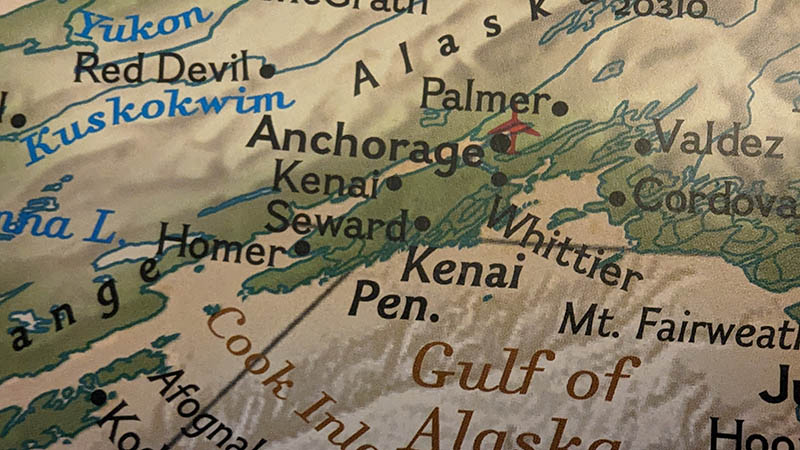
Published onThe Port of Kenai was initially homesteaded by Northwestern Fisheries Co. in 1912. The original structures were comprised of one main cannery with several warehouses along with various wooden docks and boardwalks. 1945, it was rebuilt into today's existing systems after a fire consumed the old buildings. In the late 1960s construction was done adding the concrete dock, which was repurposed from the Port of Anchorage, along with additional upgrades. Later it began operating as the Dragnet Fisheries Plant and was one of the largest canneries on the peninsula until it stopped operation in the 1990's. KENAI WEATHER !function(d,s,id){var js,fjs=d.getElementsByTagName(s)[0];if(!d.getElementById(id)){js=d.createElement(s);js.id=id;js.src='https://weatherwidget.io/js/widget.min.js';fjs.parentNode.insertBefore(js,fjs);}}(document,'script','weatherwidget-io-js');
Read MoreKetchikan
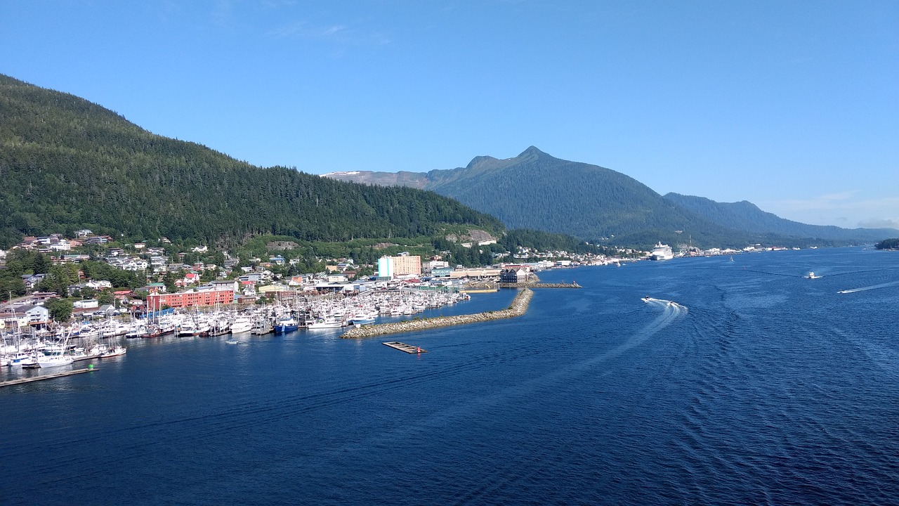
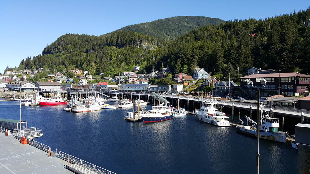
Published onKetchikan has four panamax sized cruise ship berths. They are numbered sequentially from south to north, along the downtown waterfront. Each berth also has an adjacent float. Daly Float is 200 feet long and is located on the inboard side of Berth I. Ryus Float is 150 feet long and is located at the north end of Berths II. Berth III has a 400 foot long float on the northern, inboard side of the berth. Berth IV has two floats. The first is 120 feet long and is on the southern, inboard side of the berth and the second is 70 feet long and is located on the northern, inboard side of the berth. KETCHIKAN WEATHER !function(d,s,id){var js,fjs=d.getElementsByTagName(s)[0];if(!d.getElementById(id)){js=d.createElement(s);js.id=id;js.src='https://weatherwidget.io/js/widget.min.js';fjs.parentNode.insertBefore ...
Read MoreKing Cove
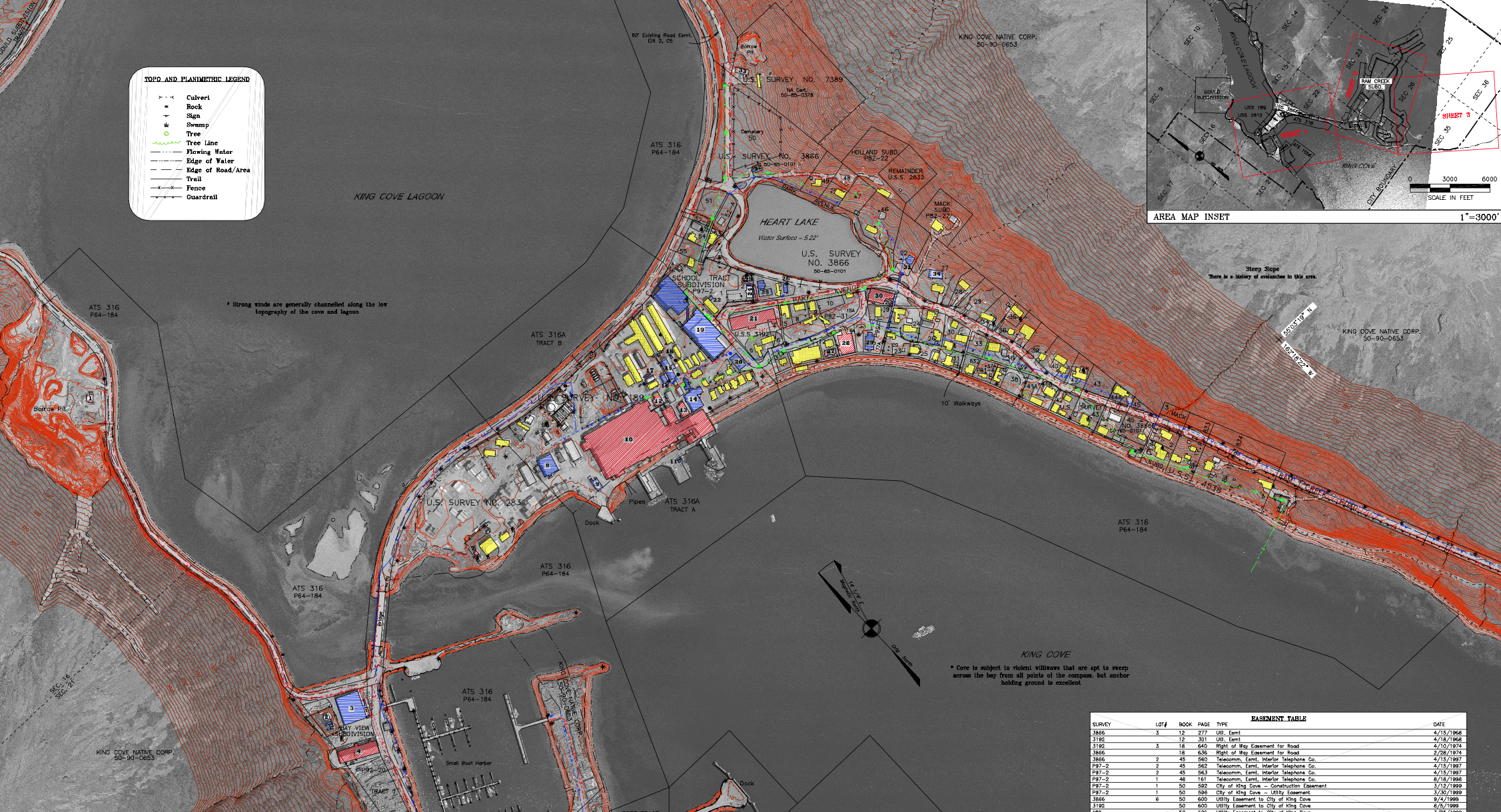
Published onThe Port of King Cove offers marine and dock-age services that support commercial fishing and cargo vessels, passengers, and recreational craft. TheCity of King Coveowns the port facilities, and the citys Harbor departmentoperates them. TheAlaska state ferryarrives in the Port of King Cove monthly from May until September, using the deep water pier. The Port of King Coves small boat harbor can accommodate 50 vessels of up to 60 feet long also has a 150 ton travel lift and a grid. The large boat harbor in the Port of King Cove can accommodate 46 vessels of up to almost 150 feet long. Both the small and large boat harbors have shore power hook-ups. The Port of King Coves deep-water pier welcomes the state ferry, cargo vessels, and cruise ships. The Port of King Cove Harbormaster staff is available round the clock on VHF Channel 6, 16, and ...
Read MoreKodiak
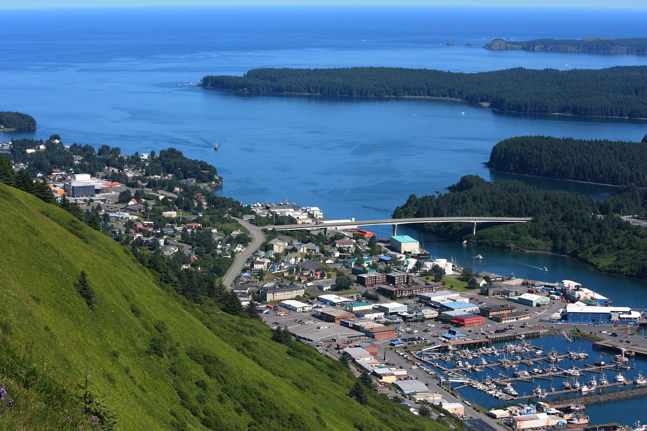
Published onKodiak is proud to offer a full range of dockage, boat yard and marine services for commercial fishing, cargo, passenger, and recreational vessels. The facilities are owned by the City of Kodiak; operated, and maintained by the City's Harbor Department. Two harbors provide protected moorage for 650 vessels up to 150 feet in length. Large vessels, including the state ferry, cruise ships and cargo vessels are moored at the three-deepwater piers. Two inner-harbor docks are available for vessels up to 120 feet that may be used for loading and maintenance activities. All vessels must register with the Harbormaster's office for moorage, services, and dockage. Electricity and water are available at several locations and in most slips. Other services provided upon request. If you are not familiar with Kodiak's port and harbor facilities, please call or visit the Harbormasters office. Comments and suggestions to improve service ...
Read MoreLa Conner
Published onThe La Conner Marina is a popular destination for recreational boaters, commercial fishers and marine-related businesses and manufacturers. Located within easy walking distance of charming downtown La Conner, the marina is a clean, service-oriented facility that tourists and La Conner residents alike enjoy visiting. Just as important, its an easy two hour cruise from the marina into the heart of the beautiful San Juan Islands. The Port of Skagit completed construction of its 300-slip moorage facility in what is now the South Basin in 1970. The North Basin was built in 1978. The Port added dry boat storage and commercial boat moorage spaces after that. Today, the La Conner Marina features two separate moorage basins, which together cover approximately 24 acres. The marina has 366 covered moorage slips, 131 open moorage slips plus 2,400 lineal feet of dock space for overnight moorage. Whether its the fine ...
Read MoreLa Push
Published onThe Quileute Harbor Marina is the only port between Neah Bay and West Port. The Marina can accommodate between 40 to 60 boats up to 50 feet in length. Docks A and B are newly refurbished with new steel piling and hook-ups. Contact the Harbor Master for current rates and availability information for the following: Fuel (Market Price) Boat Launch -call for current price Moorage (Dependent on Boat Size) LA PUSH WEATHER !function(d,s,id){var js,fjs=d.getElementsByTagName(s)[0];if(!d.getElementById(id)){js=d.createElement(s);js.id=id;js.src='https://weatherwidget.io/js/widget.min.js';fjs.parentNode.insertBefore(js,fjs);}}(document,'script','weatherwidget-io-js');
Read MoreMetlakatla
Published onMetlakatla City Dock is a public dock located in the town of Metlakatla, Alaska, providing access to the water for fishing and transportation. The Metlakatla Indian Community (MIC) is located on Annette Islands, it is the only Indian Reserve in the State of Alaska. The Reserve is 20 miles south of Ketchikan, Alaska and typically reached by seaplane, boat or ferry. METLAKATLA WEATHER !function(d,s,id){var js,fjs=d.getElementsByTagName(s)[0];if(!d.getElementById(id)){js=d.createElement(s);js.id=id;js.src='https://weatherwidget.io/js/widget.min.js';fjs.parentNode.insertBefore(js,fjs);}}(document,'script','weatherwidget-io-js');
Read MoreMoss Landing
Published onThe Moss Landing Harbor is the number one commercial fishing harbor in the Monterey Bay with 600+ slips for recreational boaters and commercial vessels. Partnering with marine research and education, the Moss Landing Harbor District (MLHD) provides full public access to the environment. Designated as a year round port of safe refuge, Moss Landing Harbor provides safe, reliable marine refuge and services to boating members of this community and welcomed guests. Moss Landing Harbor District continually strives to protect the surrounding natural resources and preserve our fishing heritage, not only for the enjoyment of this generation but for generations to come. MOSS LANDING WEATHER !function(d,s,id){var js,fjs=d.getElementsByTagName(s)[0];if(!d.getElementById(id)){js=d.createElement(s);js.id=id;js.src='https://weatherwidget.io/js/widget.min.js';fjs.parentNode.insertBefore(js,fjs);}}(document,'script','weatherwidget-io-js');
Read MoreNaknek/ King Salmon
Published onThe Port of Bristol Bay is the largest commercial freight dock in Bristol Bay and a shipping hub for Southwestern Alaska from Dutch Harbor to Bethel. From early May through July, the terminal is operating 24 hours a day/seven days a week to handle the loading and discharging of vessels and trucks and staging and distributing cargo. About 1.5 million gallons of fuel, and about $1 Billion of fish cross our Port every year in addition to normal shipping activity such as freight delivery. NAKNEK WEATHER !function(d,s,id){var js,fjs=d.getElementsByTagName(s)[0];if(!d.getElementById(id)){js=d.createElement(s);js.id=id;js.src='https://weatherwidget.io/js/widget.min.js';fjs.parentNode.insertBefore(js,fjs);}}(document,'script','weatherwidget-io-js');
Read MoreNeah Bay (Makah Marina)
Published onThe Makah Marina is a fully serviced marina at Neah Bay, Washinton. The slips vary from 30 ft. to 70 ft. The fuel dock has fuel and lubricants. There is parking for trailers and cars that can be book for short term or long term stays. Restrooms, showers and power are all available. NEAH BAY WEATHER !function(d,s,id){var js,fjs=d.getElementsByTagName(s)[0];if(!d.getElementById(id)){js=d.createElement(s);js.id=id;js.src='https://weatherwidget.io/js/widget.min.js';fjs.parentNode.insertBefore(js,fjs);}}(document,'script','weatherwidget-io-js');
Read MoreNewport
Published onThe Port of Newport is located on the central Oregon coast in the City of Newport, Lincoln County seat and major business/economic hub of the area, and encompasses approximately 59 square miles and has an estimated population of 10,800 persons. Port boundaries reach north to Otter Rock, east up to six miles inland, south to Seal Rock, and west to the Pacific Ocean. Commercial and sport fishing, fish processing, shipping, tourism, recreation, and lumber and wood processing are the areas major industries. NEWPORT WEATHER !function(d,s,id){var js,fjs=d.getElementsByTagName(s)[0];if(!d.getElementById(id)){js=d.createElement(s);js.id=id;js.src='https://weatherwidget.io/js/widget.min.js';fjs.parentNode.insertBefore(js,fjs);}}(document,'script','weatherwidget-io-js');
Read More


