“Moderate to major” impacts on commercial fishing would be expected with construction of the planned South Fork offshore wind energy project south of Rhode Island, according to the Bureau of Ocean Energy Management’s final environmental impact statement.
“These impacts would occur due to the increased presence of offshore structures (cable protection measures and foundations) that could reduce fishing access and increase the risk of fishing gear damage/loss,” the report states. “The extent of adverse impacts would vary by fishery and fishing operation due to differences in target species, gear type, and predominant location of fishing activity.”
Some for-hire recreational fishing operators could see long-term opportunities for fishing near turbines, when construction of towers and their rock scour protection creates an artificial reef effect to attract some species, the report notes.
But for commercial fishing, with mitigation measures – including changes to turbine spacing and location, burying power cables, and providing financial compensation for fishermen – “the moderate to major impact rating for commercial fisheries could decrease to moderate,” according to the analysis.
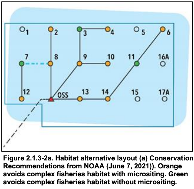
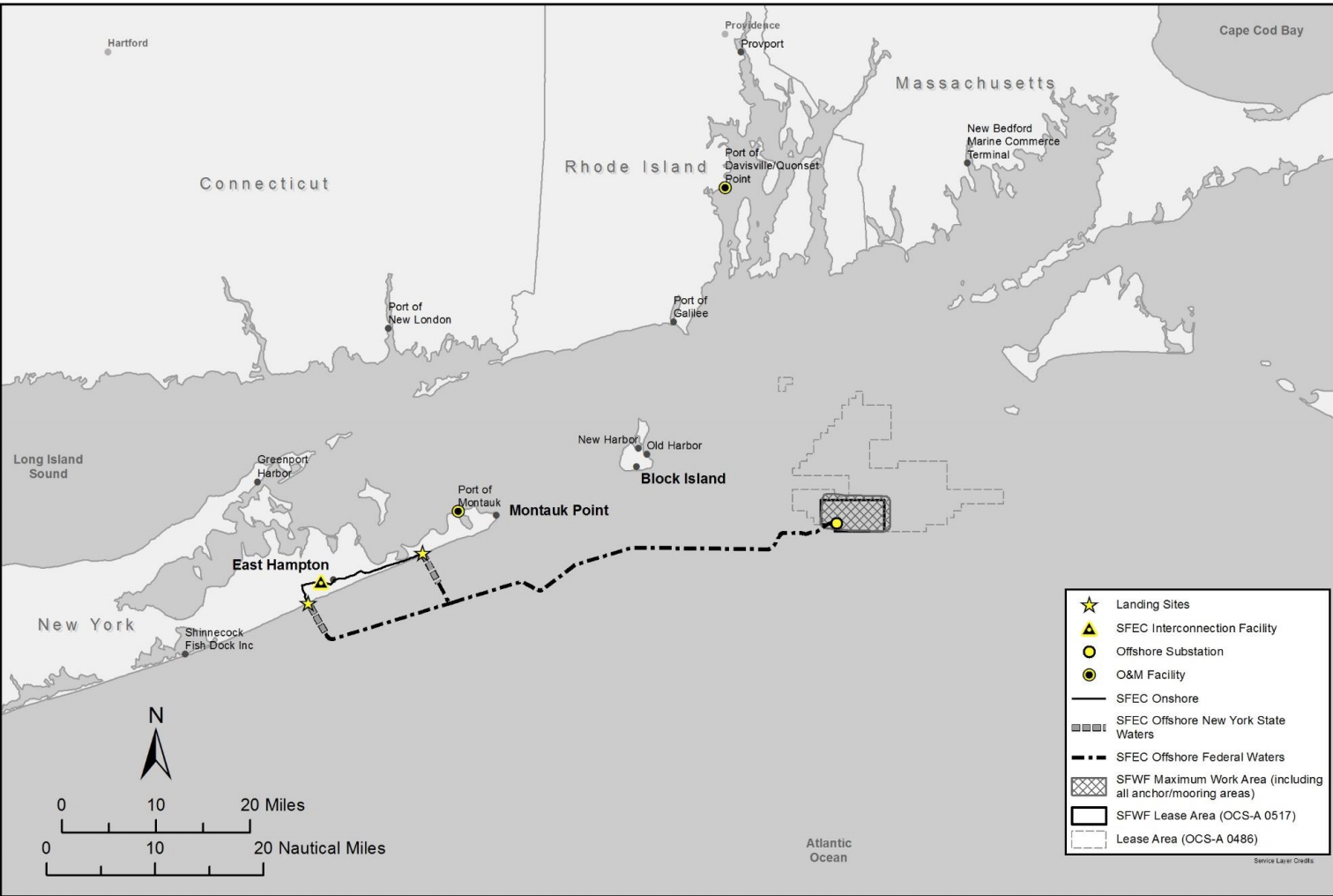
The plan by wind developer Ørsted and partners Eversource is for 15 wind turbines of up to 12 megawatts capacity each, located 35 miles east of Montauk Point, N.Y. It’s generating intense scrutiny for its potential effects on fisheries, and the BOEM environmental impact statement includes consideration of alternative turbine layouts to reduce impacts on bottom habitat.
That could lead BOEM to require the developers exclude some turbine and associated cable locations within the lease, “if micro siting to avoid complex habitat is not possible while maintaining a uniform east–west and north–south grid.” of 1-nautical-mile spacing between towers and providing diagonal transit lanes of at least 0.6 nm wide, according to the statement.
In June NMFS gave BOEM its recommendations for saving complex habitat in the lease area, including shifting turbine locations. The EIS gives a detailed summary of the ongoing discussions between agencies and the developers over how a final plan might look.

The statement notes there is a history of excluding fishing grounds from wind planning in the area – specifically Cox’s Ledge, which was included when BOEM began to outline a potential wind energy area in 2010.
“Over the 2008–2019 period, the excluded area accounted for approximately 22 percent of the revenue generated by all fisheries in the call area,” according to the statement. “It accounted for 32% of the sea scallop FMP fishery revenue and 25 percent of the monkfish FMP fishery revenue in the call area.”
For those fisheries combined, the revenue per square mile in the excluded area was approximately 50 percent” than inside the Rhode Island and Massachusetts wind energy areas from 2007 to 2018.
Fishermen have said they would not enter turbine arrays for safety during bad weather or low visibility, the statement notes.
Moreover, “with respect to fishing vessel maneuverability restrictions (including risk of allisions)…fishermen have expressed specific concerns about fishing vessels operating trawl gear that may not be able to safely deploy gear and operate…given the size of the gear, the spacing between the wind turbine generators, and the space required to safely navigate, especially with other vessels present and during poor weather conditions.
“Trawl and dredge vessel operators have commented that less than 1-nm spacing between wind turbine generators may not be enough to operate safely due to maneuverability of fishing gear and gear not directly following in line with vessel orientation.”


