


October 7, 2024
Hurricane Milton ‘explosively intensifies’ to category 5

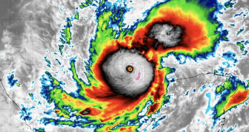
Hurricane Milton 'explosively' intensified into a category 5 storm Monday afternoon, according to the National Hurricane Center. NOAA GOES-16 satellite image.
Hurricane Milton is headed toward landfall on the west coast of Florida in the early morning hours of Thursday, after suddenly growing into one of the most intense cyclones ever seen in the Gulf of Mexico.
Widespread evacuation orders were issued in Florida coastal counties, ahead of the potential for devasting storm surges in what will be the state’s third major hurricane this season.
At. 2 p.m. Eastern time a NOAA and Air Force Reserve Hurricane Hunter air crew reported wind gusts in the…

You've caught the limit!
Free membership gives you access to:
- Unrestricted access to all NationalFisherman.com articles.
- Receive in-depth reports and research on various topics related to the fishing industry.
- Up-to-date news updates from the fishing industry delivered directly to your inbox twice a week.

