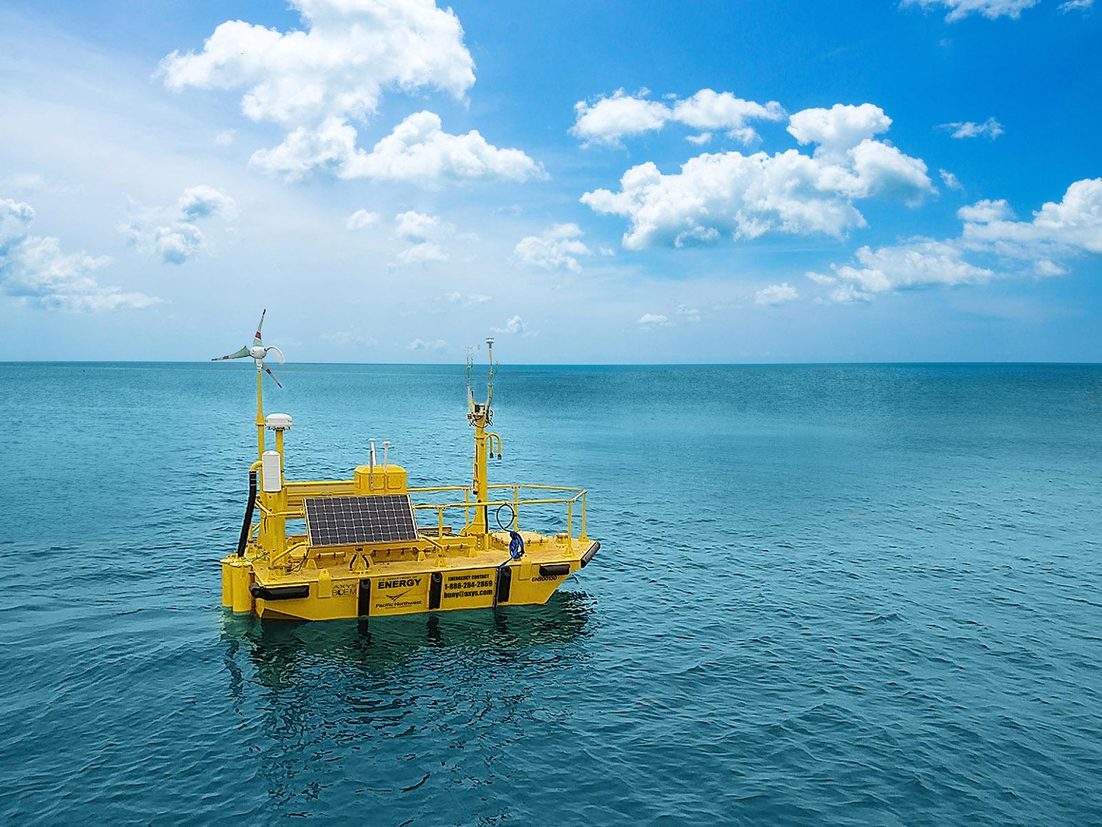
The U.S. Department of Energy has deployed two offshore wind research buoys off California for the first time, an early step toward potential leasing of wind energy sites in the Pacific.
Funded by the Bureau of Offshore Energy Management, the buoys’ mission is to gather meteorological and oceanographic data in potential wind energy areas, according to the DOE Pacific Northwest National Laboratory, which is managing the program.
One buoy is on station off the northern California coast, over depths of 2,050 feet off Humboldt County. The second is deployed over 3,280-foot depths in Morro Bay, off the central coast.
With even nearshore waters far deeper than the shallow East Coast continental shelf, BOEM and wind power companies are looking ahead to planning future arrays of floating, anchored turbines.
The plan is to keep the buoys on station to gather data over the next 12 months, according to Alicia Gordon, project manager of marine renewable and offshore wind energy projects for the lab, based in Richland, Wash.
“The measurements they obtain will provide BOEM and offshore wind stakeholders with the most accurate and detailed information needed to make solid decisions regarding wind energy development, such as siting and design considerations,” Gordon said in a statement from the lab describing the research plan.
Instrumentation on the buoys capture measurements including wind speed and direction at multiple heights, air and sea surface temperatures, ocean current speeds and directions, and wave heights and directions.
The buoys were deployed in the early years of studying East Coast sites, off New Jersey and Virginia from 2014 through 2017. For a 2020 upgrade $1.3 million was invested in re-equipping the buoys with more powerful lidar (light direction and ranging) technology to measure wind up to 820 feet above the sea surface – the nacelle height of the coming generation of 12- and 14-megawatt turbines BOEM and the industry anticipate.
That upgrade also involved moving the associated data management system to an open-source platform, “for easier data access by the wind scientific community at large,” according to lab officials.
During testing the buoys’ performance was validated against a reference lidar off the coast of Martha’s Vineyard, where Vineyard Wind and other developers are planning arrays off southern New England. The buoys were then sent to the West Coast over the summer from deployment.
The Pacific Northwest lab’s analysis of the buoy data “will be used to validate wind models, improve the understanding of air-sea interactions, and reduce uncertainty and risk in characterizing offshore wind resources,” according to lab officials. “The data will be stored in the Data Archive and Portal, also managed by PNNL, where it will be publicly available to the wind research community.”
In spring 2021, the northern coast buoy will probably be additionally equipped with ThermalTracker, a system developed at the lab to measure bird and bat activity.
“The system consists of thermal cameras and software that uses stereo vision processing to provide three-dimensional flight data about birds and bats around wind turbines,” according to lab officials. “The data from ThermalTracker—flight height, speed, and passage rates, for instance—will provide offshore wind developers with the information they need to understand avian behavior around wind technologies so they can best plan development and operations.”


